The Global Positioning System (GPS) has become a ubiquitous technology that most people use daily, often without much thought about how it works. Whether you're navigating your way through a new city, tracking a delivery, or using location-based services, GPS systems help determine your precise location anywhere on Earth. But what is the science behind GPS? How does it determine a location with such incredible accuracy? The answer lies in physics, specifically in the interplay of concepts from relativity, time synchronization, and the behavior of electromagnetic waves. This article will explore how GPS works, emphasizing the role of physics in determining locations.
What is GPS?
The Global Positioning System (GPS) is a satellite-based navigation system that provides location and time information to a GPS receiver. The system was developed by the U.S. Department of Defense in the 1970s, primarily for military use, but it became widely available to civilians in the 1980s. A GPS system works by triangulating signals from a network of satellites orbiting the Earth, using the speed of light and highly accurate atomic clocks. GPS devices can calculate the precise position of an object in three-dimensional space -- latitude, longitude, and altitude -- and can also provide the current time.
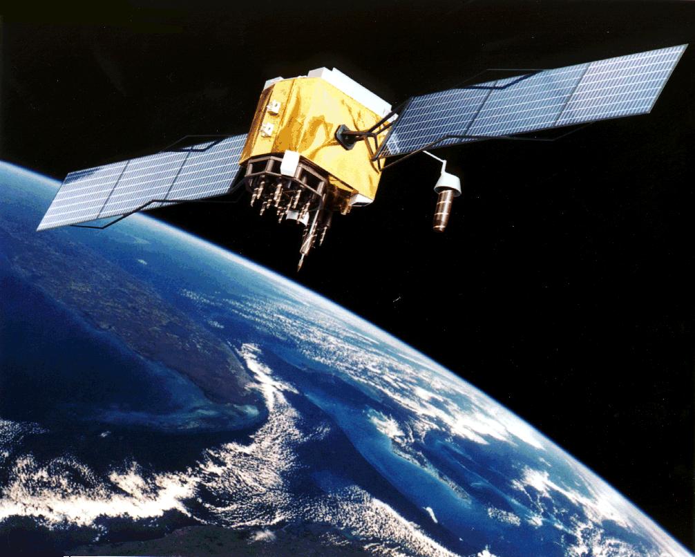
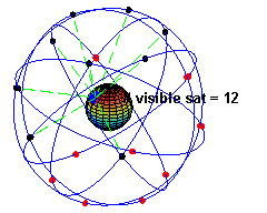
At the heart of the GPS system are the 24 satellites that orbit the Earth. These satellites continuously broadcast signals that contain information about their location and the time the signal was transmitted. GPS receivers on the ground (or in a vehicle, smartphone, etc.) listen to these signals and use them to calculate the user's position.
How Does GPS Work?
The basic principle behind GPS is based on measuring the time it takes for signals to travel from satellites to a GPS receiver. Since the signals travel at the speed of light, this travel time can be converted into a distance measurement. To determine a location, at least four satellites must be involved:
Distance Measurement: The receiver calculates the distance to each satellite by measuring how long it takes for the signal to arrive. This is done by noting the time difference between when the signal was sent from the satellite and when it was received.
Triangulation: Once the distances to multiple satellites are known, the receiver uses the principle of triangulation to calculate its position. With at least three satellites, the receiver can determine its position in two dimensions (latitude and longitude). With a fourth satellite, the receiver can also calculate altitude, completing the three-dimensional positioning.
Time Synchronization: Accurate time measurement is crucial for GPS systems. The signals from satellites contain the exact time the signal was transmitted, which is based on the atomic clocks aboard the satellites. By comparing the time of receipt of the signal with the satellite's transmitted time, the GPS receiver can determine the signal's travel time and, therefore, the distance to the satellite.
Physics Principles Behind GPS
The ability of GPS to accurately determine locations is rooted in the application of several key concepts in physics, especially from the fields of relativity, electromagnetic theory, and time synchronization.
1. The Speed of Light and Electromagnetic Waves
The core physics behind GPS lies in the behavior of electromagnetic waves. GPS satellites continuously transmit signals that are electromagnetic waves, which travel at the speed of light. The speed of light in a vacuum is approximately 299,792,458 meters per second (about 186,282 miles per second).
When a GPS receiver receives a signal from a satellite, it can measure the time it took for the signal to travel. By multiplying the time by the speed of light, the receiver can calculate how far the satellite is. The satellite's position is known precisely, so knowing the distance from multiple satellites allows the receiver to calculate its own position.
The physics of electromagnetic waves in free space and the known speed of light make it possible to calculate the distance between the satellites and the receiver with high precision.
The physics of electromagnetic waves in free space and the known speed of light make it possible to calculate the distance between the satellites and the receiver with high precision.
2. The Theory of Relativity
While the speed of light is fundamental to GPS, there are two more crucial factors: Einstein's theories of special and general relativity. These theories account for the differences in how time flows at different speeds and gravitational fields, which is critical for ensuring the accuracy of the GPS system.
Special Relativity
According to Einstein's theory of special relativity, time runs slower for objects moving at high velocities relative to a stationary observer. Since the GPS satellites are moving at speeds of several kilometers per second (about 14,000 km/h), their onboard clocks tick slightly slower than clocks on Earth. This effect, called time dilation, means that the atomic clocks on the satellites will tick a little slower compared to those on the Earth's surface.
The relativistic time dilation effect causes the satellite clocks to fall behind Earth clocks by about 7 microseconds per day. If this effect were not taken into account, the calculated positions would be off by several kilometers every day.
General Relativity
In addition to the effects of motion, general relativity also plays a role. General relativity tells us that gravity affects the passage of time. The GPS satellites are orbiting at a much higher altitude than objects on the Earth's surface, meaning they experience a weaker gravitational field.
According to general relativity, clocks run faster in weaker gravitational fields. Therefore, the atomic clocks on the satellites tick slightly faster than clocks on Earth. This difference is about 45 microseconds per day.
When combined, these two relativistic effects - the time dilation due to the satellite's high velocity and the gravitational time dilation due to their altitude - amount to a net difference of about 38 microseconds per day. Without correcting for this discrepancy, the GPS system would experience errors of up to 10 kilometers per day.
3. Time Synchronization and Atomic Clocks
Accurate time measurement is crucial for GPS to function. The satellites are equipped with highly precise atomic clocks, typically cesium or rubidium-based, which are capable of measuring time with an accuracy of up to one billionth of a second. These clocks are synchronized with the clocks on the Earth's surface, ensuring that the signals broadcast by the satellites contain accurate timestamps.
Since the speed of light is constant, the distance between the satellite and the receiver is determined by the time delay between when the signal was transmitted from the satellite and when it was received. However, the GPS receiver is not typically equipped with atomic clocks as precise as those on the satellites. Instead, the receiver needs to calculate the time delay based on the signals received from multiple satellites. This is why at least four satellites are necessary for an accurate position fix: one to determine the position, another to account for time errors, and the third and fourth to improve the accuracy.
Why Four Satellites?
In an ideal situation, three satellites would be enough to determine a receiver's position in two dimensions, as mentioned earlier. However, due to the necessity of accounting for time synchronization errors in the receiver's clock, a fourth satellite is required. By comparing the time delay data from four satellites, the receiver can solve for both the three-dimensional location (latitude, longitude, and altitude) and the error in its own clock.
Without the fourth satellite, the receiver's internal clock would introduce significant errors in its position calculations. The additional satellite helps compensate for this clock error, ensuring that the receiver can calculate both its position and the accurate time.
The Role of Atmospheric Effects
Another factor that can affect the accuracy of GPS signals is the Earth's atmosphere. As GPS signals travel through the atmosphere, they are delayed due to interactions with particles in the ionosphere and troposphere. The ionosphere, in particular, can cause delays that depend on the density of free electrons, which varies with time of day, solar activity, and location. GPS receivers use sophisticated algorithms to model and correct for these delays, but atmospheric conditions can still introduce small errors.
Conclusion
The Global Positioning System relies on advanced physics to determine the position of objects with extraordinary precision. The physics of electromagnetic waves traveling at the speed of light, the relativistic effects from Einstein's theories, and the accurate synchronization of time using atomic clocks all work together to enable GPS to function. Without these fundamental principles of physics, GPS would not be the reliable and ubiquitous technology that it is today.
Understanding how GPS uses physics provides a deeper appreciation of the system's complexity and the extraordinary accuracy it can achieve. While the core idea of GPS -- measuring distances based on the time it takes for a signal to travel -- seems simple, it is the careful application of physics that makes GPS possible and reliable, providing a critical service for modern navigation and positioning.
You can learn these concepts and more at Dr Hock's maths and physics tuition.